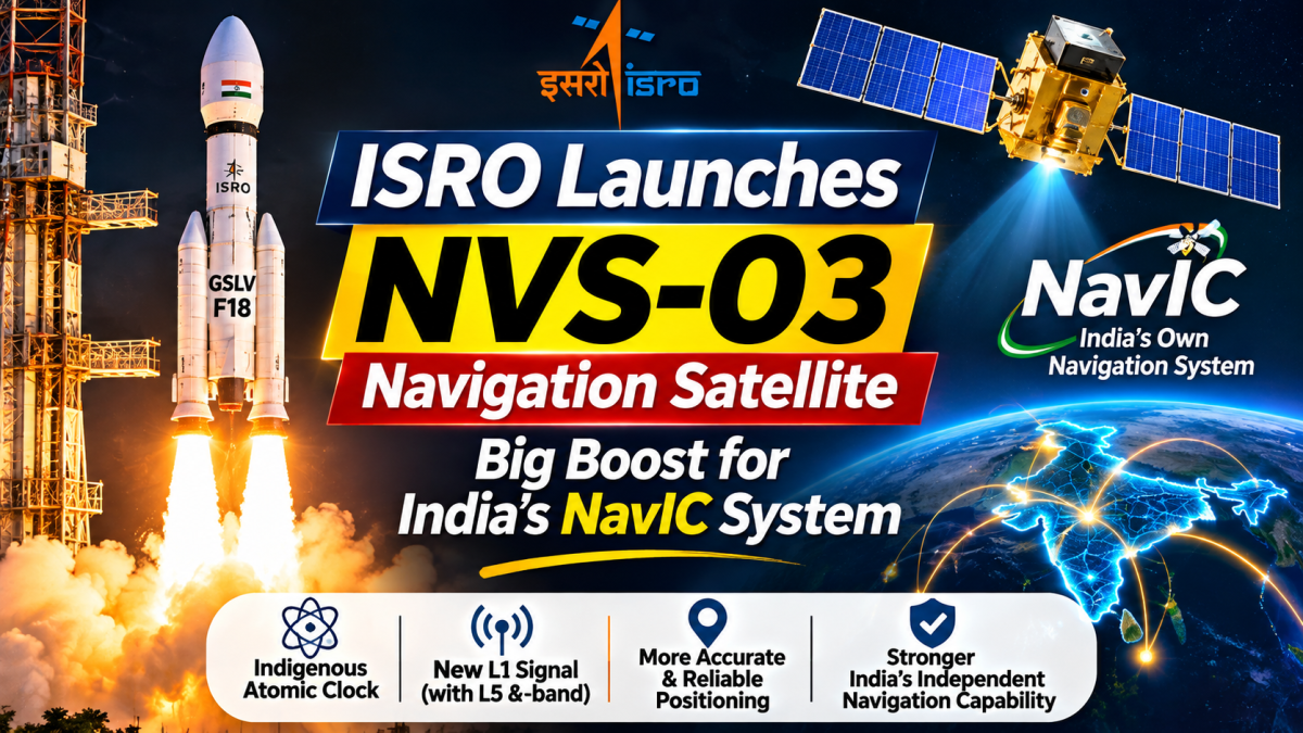
India's space programme has taken another important step towards strengthening its independent satellite navigation capabilities. ISRO successfully launched the NVS-03 navigation satellite aboard the GSLV-F18 rocket from Sriharikota on October 30, 2026. Equipped with an indigenous atomic clock and additional navigation signals, the satellite is designed to strengthen NavIC, India's own regional alternative to foreign satellite navigation systems.
Also Read: Pakistan’s $40 Billion Trade-Loss Claim: What India’s Data Shows
India is working towards greater independence in space-based technology, and its latest navigation satellite launch is an important part of that journey.
The Indian Space Research Organisation (ISRO) successfully launched NVS-03 on October 30, 2026, aboard the Geosynchronous Satellite Launch Vehicle GSLV-F18 from the Satish Dhawan Space Centre in Sriharikota, Andhra Pradesh.
The mission was completed at 11:51 PM Indian Standard Time.
NVS-03 is the third satellite in India's second-generation navigation satellite series and is designed to strengthen the country's indigenous Navigation with Indian Constellation (NavIC) system.
What makes this mission particularly important is the technology carried aboard the satellite. NVS-03 includes an indigenously developed atomic clock alongside procured atomic clocks. It also incorporates an L1 navigation signal in addition to the existing L5 and S-band signals.
These technologies are expected to support the continuity, compatibility and reliability of India's satellite-based positioning, navigation and timing services.
According to ISRO's official mission update, the GSLV-F18 mission successfully placed NVS-03 into its intended Geosynchronous Transfer Orbit (GTO).
ISRO's GSLV-F18 Mission: What Happened During the NVS-03 Launch?
The successful launch of NVS-03 marks the 20th flight of India's Geosynchronous Satellite Launch Vehicle (GSLV).
The rocket lifted off from the Second Launch Pad at the Satish Dhawan Space Centre, carrying the navigation satellite towards its designated orbit.
The launch vehicle successfully injected NVS-03 into a Geosynchronous Transfer Orbit, the initial elliptical orbit used by spacecraft before they are moved towards their final geosynchronous positions.
The mission was completed successfully, but the satellite still needed additional orbit-raising manoeuvres before reaching its designated orbital position.
ISRO subsequently confirmed that the first orbit manoeuvre was successfully completed on October 31, 2026, at 4:48 PM IST.
During this operation, the satellite's Liquid Apogee Motor (LAM) was fired for approximately 2,174.8 seconds to raise its orbit.
Following the manoeuvre, the estimated orbit was approximately 5,477.6 km by 37,833.4 km. ISRO also confirmed that the satellite's health was normal.
Further orbital manoeuvres were planned to eventually position the spacecraft at its designated geosynchronous orbital location of 111.75° East.
These details were published in ISRO's October 31 update on NVS-03's orbit manoeuvring.
What Is NVS-03 and Why Is It Important for India?
NVS-03 belongs to India's second-generation satellite navigation programme, developed to strengthen and maintain the country's regional navigation infrastructure.
The satellite is the third in a planned series of five next-generation navigation satellites, identified as NVS-01, NVS-02, NVS-03, NVS-04 and NVS-05.
The programme is intended to improve the continuity and capabilities of NavIC, which was previously known as the Indian Regional Navigation Satellite System (IRNSS).
Unlike ordinary communication satellites, navigation satellites serve a different purpose. They transmit highly precise timing and positioning signals that receivers on Earth use to calculate their location, movement and time.
These services are important for applications ranging from road transportation and maritime navigation to aviation, surveying, disaster management and strategic operations.
According to the Ministry of Information and Broadcasting's NVS-03 factsheet, published through the Press Information Bureau on November 1, 2026, the satellite is intended to strengthen India's independent satellite navigation capabilities.
What Is NavIC? Understanding India's Indigenous Alternative to GPS
Most people are familiar with GPS, the Global Positioning System used in smartphones, vehicles and navigation devices.
However, GPS is operated by the United States. India has also developed its own independent regional satellite navigation system known as NavIC (Navigation with Indian Constellation).
Developed by ISRO, NavIC provides Positioning, Navigation and Timing (PNT) services across India's landmass and a region extending approximately 1,500 kilometres beyond the country's geopolitical boundary.
The system is designed to provide two types of navigation services:
1. Standard Positioning Service (SPS)
This service is intended for civilian users. It can support applications such as vehicle navigation, transportation, personal mobility, maritime operations and location-based services.
2. Restricted Service (RS)
This is an authorised, encrypted service intended for strategic users.
According to ISRO's official Satellite Navigation Services documentation, NavIC's coverage includes India and an area extending up to 1,500 kilometres beyond its boundary.
This distinction is important: NavIC is a regional navigation system, not a global replacement for GPS.
Its importance lies in providing India with an independently developed navigation infrastructure that can support civilian and strategic requirements.
Indigenous Atomic Clock: The Technology Behind NVS-03
One of the most important technologies aboard NVS-03 is its indigenous atomic clock.
To understand why this matters, it helps to understand how satellite navigation actually works.
Navigation satellites continuously transmit signals containing information about their position and extremely precise timing.
A receiver, such as a smartphone or vehicle navigation device, calculates its position by measuring how long signals take to travel from multiple satellites.
Even a very small error in timing can translate into a significant error in the calculated position.
This is why precise atomic clocks are essential to satellite navigation systems.
NVS-03 carries an indigenously developed atomic clock alongside procured atomic clocks.
The inclusion of indigenous clock technology represents progress in India's ability to develop critical components required for its own navigation infrastructure.
It is particularly significant because precision timing technology has applications beyond navigation, including telecommunications, scientific measurements and strategic systems.
However, the presence of an indigenous atomic clock should not be confused with the satellite carrying only domestically manufactured clocks. ISRO has confirmed that the spacecraft carries both indigenous and procured atomic clocks.
What Is New About the L1 Navigation Signal in NVS-03?
Another important feature of NVS-03 is the addition of the L1 navigation signal alongside the existing L5 and S-band signals.
Navigation satellite systems use different radio-frequency bands to transmit positioning and timing information.
The L1 band is particularly relevant because it is also used by major global satellite navigation systems.
By incorporating L1 signals into its next-generation NavIC satellites, India is expanding the technical compatibility of its navigation system with other satellite navigation technologies.
This could make it easier for compatible receiver manufacturers to incorporate NavIC signals into navigation devices.
ISRO's Satellite Navigation Services page explains that the civilian NavIC L1 signal is interoperable with other global navigation satellite system signals.
The addition of L1 alongside L5 and S-band signals is therefore an important part of the evolution of NavIC.
It provides greater flexibility for receiver manufacturers and supports the development of devices capable of using multiple satellite navigation systems.
How Could NVS-03 Benefit Ordinary People in India?
Satellite navigation is not limited to military operations or specialised scientific research.
It is already an important part of everyday life, even when people do not directly notice the technology operating in the background.
Navigation services support several areas of economic and public activity.
1. Better Support for Transportation and Vehicle Navigation
Navigation technology is widely used in road transportation, fleet management and location-based applications.
NavIC can provide an additional regional positioning source for compatible devices.
This is relevant for vehicle tracking, logistics companies, transport operators and other businesses that depend on reliable location information.
2. Support for Aviation
Aircraft depend on accurate positioning and timing information for navigation and other operational requirements.
Satellite navigation technologies can support aviation applications, including route monitoring and positioning services.
NavIC is designed to contribute to India's broader satellite navigation infrastructure, although aviation use requires appropriate certified equipment and regulatory approval.
3. Maritime Navigation and Fishermen's Safety
India has extensive coastal regions and a large maritime economy.
Navigation information is important for ships, fishing vessels and maritime operators.
Satellite-based positioning can support route planning, location awareness and maritime operations, particularly in areas where terrestrial connectivity is limited.
4. Precision Agriculture
Agriculture is another area where navigation technology has growing importance.
Accurate positioning can support agricultural surveying, mapping, precision farming equipment and the operation of agricultural drones.
NavIC's navigation capabilities can contribute to these applications through compatible receivers and supporting technologies.
5. Disaster Management
During floods, cyclones and other emergencies, accurate location information can help authorities coordinate response operations.
Satellite navigation can support the positioning of rescue teams, vehicles and equipment.
It can also complement other satellite-based systems used for monitoring and disaster response.
These applications are consistent with the uses identified in ISRO's official navigation services documentation.
Is NavIC Better Than GPS?
This is one of the questions people may ask following the successful NVS-03 launch.
However, comparing NavIC and GPS requires understanding that they were developed with different coverage objectives.
GPS is a global satellite navigation system operated by the United States, while NavIC is India's independent regional navigation system.
NavIC focuses on providing navigation coverage over India and the surrounding region extending approximately 1,500 kilometres beyond India's geopolitical boundary.
GPS provides worldwide coverage.
For users in India, NavIC offers an additional indigenous navigation capability. Its integration into compatible devices could help strengthen the availability of positioning services.
That does not mean NavIC will automatically replace GPS or that it is universally more accurate.
The actual performance experienced by users depends on several factors, including satellite visibility, receiver quality, signal conditions and compatibility.
The two systems can also operate together in compatible devices.
The long-term value of NavIC is its ability to give India greater control over an important part of its navigation infrastructure.
Does NVS-03 Mean Your Smartphone Will Start Using India's NavIC?
Not automatically.
The successful launch of a navigation satellite does not mean that every smartphone or navigation device will immediately begin receiving its signals.
A device must have a compatible chipset and receiver capable of processing the relevant NavIC frequencies.
Device manufacturers must also implement the necessary software and system support.
The inclusion of L1 in the next-generation NavIC series is important because it creates additional opportunities for compatibility with multi-constellation navigation receivers.
For ordinary users, wider adoption will depend on how smartphone manufacturers, navigation companies and other technology developers integrate NavIC support into their products.
Therefore, NVS-03 strengthens India's satellite navigation infrastructure, but its benefits for individual users will depend partly on compatible devices and service readiness.
What Happens Next After the Successful NVS-03 Launch?
The successful launch was the first major milestone in the mission.
After reaching its initial transfer orbit, the satellite underwent orbit-raising manoeuvres to move towards its designated geosynchronous position.
ISRO confirmed the successful completion of the first orbit manoeuvre on October 31 and reported that the satellite's health was normal.
At the time of the latest publicly available ISRO orbit update reviewed for this report, further manoeuvres were still planned to place NVS-03 in its designated orbital slot at 111.75° East.
Once the satellite reaches its designated position, additional in-orbit checks and commissioning will be necessary before it can contribute operationally to the navigation constellation.
This distinction matters because a successful rocket launch and an operational navigation satellite are two different stages of a space mission.
The next milestones will therefore involve completing the orbital positioning process and verifying the satellite's navigation payload.
Why NVS-03 Matters for India's Space Technology Future
India's space programme is increasingly focused not only on launching satellites but also on developing the technologies and infrastructure needed to operate independent space-based services.
NavIC is an important part of that strategy.
Navigation infrastructure supports multiple sectors, including transport, communications, maritime operations, aviation, agriculture and national security.
The NVS-03 mission adds another satellite to India's next-generation navigation programme while introducing additional signal capabilities and indigenous timing technology.
It also highlights the importance of developing domestic expertise in specialised technologies such as atomic clocks, satellite payloads and navigation signal generation.
The success of the mission does not mean that every challenge facing NavIC has been resolved. The remaining next-generation satellites, ground infrastructure, compatible receivers and operational commissioning will all play important roles in the system's future.
However, NVS-03 represents a meaningful step towards strengthening India's ability to manage its own regional satellite navigation services.
India's ambition in space is not limited to reaching distant destinations. It also involves building the essential technologies that people, industries and national infrastructure can depend on every day. NVS-03 is one more step in that direction.
Frequently Asked Questions (FAQs)
1. What is NVS-03?
NVS-03 is the third satellite in India's second-generation navigation satellite series developed by ISRO to strengthen the Navigation with Indian Constellation (NavIC).
2. When did ISRO launch the NVS-03 satellite?
ISRO successfully launched NVS-03 on October 30, 2026, at 11:51 PM IST aboard the GSLV-F18 rocket from the Satish Dhawan Space Centre in Sriharikota.
3. What is the purpose of the NVS-03 satellite?
Its purpose is to strengthen India's indigenous satellite navigation system by supporting continuity of navigation services and introducing enhanced signal capabilities.
4. What is NavIC?
NavIC, or Navigation with Indian Constellation, is India's independent regional satellite navigation system developed by ISRO. It provides positioning, navigation and timing services across India and an area extending approximately 1,500 kilometres beyond its geopolitical boundary.
5. Does NVS-03 carry an indigenous atomic clock?
Yes. ISRO confirmed that NVS-03 carries an indigenously developed atomic clock alongside procured atomic clocks to support the precise timing required for satellite navigation.
6. What is the new L1 signal in NVS-03?
L1 is a radio-frequency band used by satellite navigation systems. NVS-03 includes the L1 signal alongside the existing L5 and S-band signals, supporting greater interoperability with compatible navigation receivers.
7. Is NavIC India's replacement for GPS?
NavIC is not a complete global replacement for GPS. It is India's independent regional navigation system, covering India and approximately 1,500 kilometres beyond its boundary. Compatible devices can use NavIC alongside other navigation systems.
8. Can ordinary smartphones use NavIC?
Smartphones can use NavIC when their hardware and software support the relevant navigation signals. The NVS-03 launch does not automatically make every existing smartphone compatible.
9. What is the coverage area of NavIC?
NavIC is designed to cover India's landmass and a surrounding region extending approximately 1,500 kilometres beyond India's geopolitical boundary.
10. What happens after the NVS-03 launch?
ISRO must complete the remaining orbit-raising manoeuvres, place the satellite in its designated orbital position and conduct the necessary in-orbit checks before it becomes part of operational navigation services.



Join the Conversation